
PART 1: Military History
From Philip’s Dream to the Edge of Asia
I want to start this post differently than the usual Vini Bellum format, because this one is built around a recent archaeological discovery rather than a single wine region I set out to explore. The Battle of the Granicus has been one of those ancient engagements where everyone knows the story but nobody could say with confidence exactly where it happened. That changed in late 2024, when a team from Çanakkale Onsekiz Mart University published findings that may have finally pinpointed the battlefield on the Biga Plain in northwestern Turkey. The wine connection here is real, rooted in the same Marmara coastline where grapes have been grown since Greek colonists planted them in the seventh century BCE, but the hook for this post is the archaeology. I think the discovery is worth telling, and the battle itself is one of the most consequential cavalry actions in ancient history.
To understand why Alexander was on the banks of the Granicus in the spring of 334 BCE, I need to go back to his father. Philip II of Macedon spent decades transforming the Macedonian military from a minor Balkan power into the dominant force in Greece. After defeating the combined Greek armies at Chaeronea in 338 BCE, Philip organized the League of Corinth (also called the Hellenic League), a political alliance that gave him formal authority over most of Greece and, critically, authorization for a war of vengeance against Persia. The stated justification was retribution for the Persian invasions of 490 and 480 BCE, when Xerxes I had burned Athens and desecrated Greek temples. Whether Philip genuinely cared about vengeance or simply wanted an empire is a question historians have debated since antiquity, but the political framework was in place. An advance force under Parmenion and Attalus had already crossed into Asia Minor in 336 BCE when Philip was assassinated at his daughter’s wedding in October of that year.
Alexander was twenty years old when he became king. By the time he crossed the Hellespont into Asia in May 334 BCE, he was twenty-one (turning twenty-two that July) and had already spent roughly eighteen months securing his position. He put down revolts in Thessaly and Thrace, destroyed the city of Thebes to discourage further Greek resistance, and reaffirmed Macedon’s control over the League of Corinth. None of that was easy, and none of it was the work of a boy stumbling into a crown. By the spring of 334 he had proven he could command, and he turned east with an army that ancient sources describe variously as 30,000 to 43,000 infantry and roughly 5,000 to 6,000 cavalry, including Macedonians, Thessalians, other Greek allies, Thracians, and Illyrian contingents. He crossed the Hellespont, visited the site of ancient Troy (a bit of theatrical homage to Achilles, whose legacy Alexander consciously cultivated), and marched south along the coast of Asia Minor toward the forces waiting for him.

The Battle of the Granicus
The Persian response was not coordinated from the center. Darius III, the Achaemenid king, was far to the east and had not yet taken personal command of the western defense. Instead, the satraps (provincial governors) of Asia Minor assembled their own armies near the Granicus River (today the Biga Çayı, or Biga River), a stream that flows northeastward across the Biga Plain in what is now Çanakkale Province, Turkey, before emptying into the Sea of Marmara. The Persian force included roughly 10,000 to 20,000 cavalry drawn from the satrapies of Asia Minor and about 5,000 Greek mercenary infantry under the command of Memnon of Rhodes, the most capable Persian-aligned general in the theater. The satraps chose to fight at the river, deploying their cavalry on the steep far bank with the mercenary infantry behind them.
Ancient sources record a debate before the battle. Parmenion (Alexander’s senior general and his father’s most trusted commander) reportedly advised waiting until morning rather than attacking across a defended river crossing in the late afternoon. Alexander overruled him. Whether this debate actually happened as reported, or whether Arrian and Plutarch constructed it to highlight Alexander’s boldness, the tactical decision is clear: Alexander chose to attack immediately rather than allow the Persians time to reposition or withdraw.
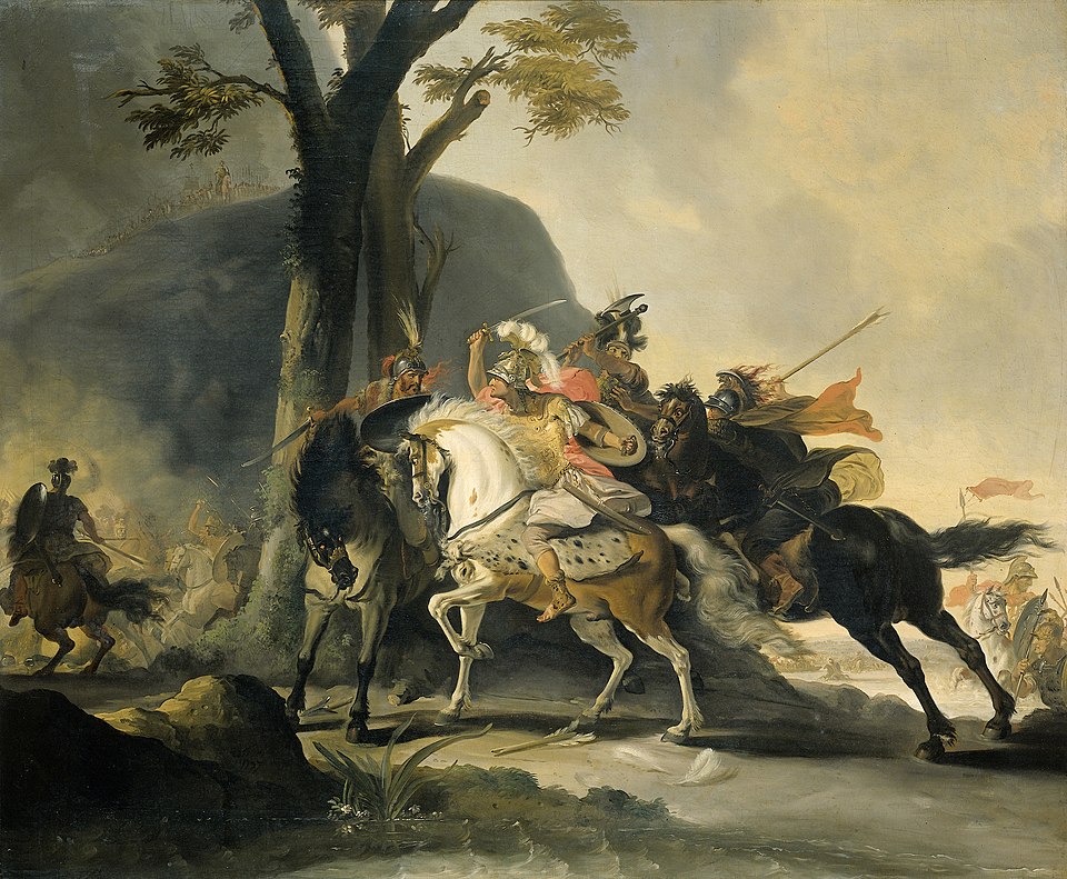
The battle that followed was primarily a cavalry action, and it was violent and personal from the start. Alexander led the Companion cavalry (his elite heavy cavalry, organized into squadrons called ilai) across the river and up the far bank. The crossing was difficult. The banks were steep and muddy, and the Macedonians came up disordered and at a disadvantage. The first riders to reach the top were met by Persian cavalry and cut down. Alexander pressed forward with the main body of the Companions, and the fighting collapsed into a close-quarters melee of horses and lances on the riverbank.


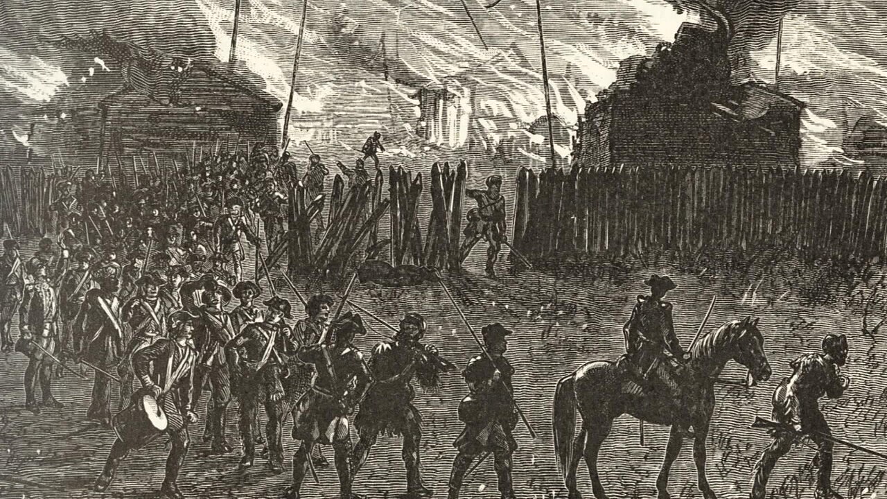
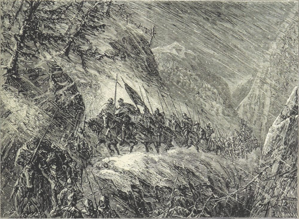
Alexander and his cavalry crossing the Biga (L) and Alexander in Battle at the Granicus (R)
It was in this melee that Alexander came closer to death than at almost any other point in his career. The satrap Rhoesaces struck Alexander’s helmet with a sword, shearing off the crest and one of the plumes. Before Alexander could recover, Spithridates (another Persian satrap) raised his weapon to deliver a killing blow from behind. Cleitus the Black (son of Dropides and commander of the Royal Squadron of the Companions) saved Alexander’s life by severing Spithridates’ sword arm before the blow could fall. This is one of the most frequently cited episodes in the ancient sources, and it deserves its place in the story. Alexander survived because Cleitus was close enough and fast enough to intervene. The irony, for those who know the later history, is that Alexander would kill Cleitus himself in a drunken rage at a banquet in Samarkand eight years later.
The Macedonian cavalry eventually gained the bank and broke the Persian horse. The superior reach of the Macedonian xyston (a long, double-pointed cavalry lance roughly three to four meters in length) proved decisive against Persian cavalrymen armed primarily with shorter javelins and swords. Once the Persian cavalry line collapsed, the satraps fled, and the Greek mercenary infantry was left isolated on the field. The mercenaries offered to surrender. Alexander refused, treating them as traitors to the Hellenic cause for serving Persia. He attacked their position. Roughly half were killed in the fighting, and the approximately 2,000 survivors were taken prisoner and sent to Macedonia in chains. Alexander sent 300 captured suits of Persian armor to Athens as a dedication to Athena on the Acropolis, inscribed with a pointed message: “Alexander, son of Philip, and the Greeks (except the Lacedaemonians) dedicate these spoils, taken from the barbarians who dwell in Asia.” The omission of Sparta was deliberate.
The consequences were immediate. The Battle of the Granicus broke the organized Persian defense of western Asia Minor. Within months, the coastal cities of Sardis, Ephesus, Miletus, and Halicarnassus fell or surrendered, and Alexander controlled the entire western seaboard of Anatolia. The Granicus was not the battle that destroyed the Persian Empire (that would come at Gaugamela in 331 BCE), but it was the battle that proved Alexander could beat a Persian army on Persian-held ground, with Persian satraps commanding Persian cavalry on terrain of their choosing. Everything that followed began here.
Finding the Field: The 2024 Archaeological Discovery
For centuries, the exact location of the Granicus battlefield eluded scholars. The ancient sources agreed on the river’s name and the general area, but the Biga River has shifted course over two millennia, and no physical evidence of the battle had been confirmed on the ground. Multiple locations along the river had been proposed and debated.
In late 2024, a team led by Professor Reyhan Körpe of Çanakkale Onsekiz Mart University published findings that represent the most compelling identification of the battlefield to date. Körpe had been working on this problem for over twenty years, beginning with the Granicus River Valley Archaeological Survey Project in 2004 and 2005. His team’s methodology combined geomorphological analysis (reconstructing what the terrain and river course looked like in the fourth century BCE) with systematic comparison against the ancient textual descriptions of the battle.
The key breakthrough was the identification of the ancient city of Hermaion, which ancient sources record as Alexander’s last encampment before the battle. Previously overlooked, traces of Hermaion were uncovered during excavations in 2024, and its position allowed Körpe’s team to map Alexander’s likely route from his crossing at the Hellespont through the Biga Plain to the battlefield itself. The proposed site features a hill east of ancient marshlands, a terrain feature that matches the descriptions in Arrian and Plutarch of elevated ground where the Persians formed their line. In 2024, farmers working fields near the southern slope of that hill also uncovered human bones and fragments of ancient weapons during plowing, adding physical evidence to the geomorphological and textual case.
This is not the kind of discovery that changes what we know about the outcome of the battle. Alexander won at the Granicus regardless of where exactly the riverbanks were. But it matters for a different reason. Locating the actual ground anchors a story that has lived almost entirely in texts for 2,300 years. It connects the written accounts of Arrian, Plutarch, and Diodorus to a specific piece of Turkish farmland where the terrain still shows what the ancient authors described. For a battle that launched one of the most consequential military campaigns in human history, that grounding in physical geography is worth having.
PART 2: Wine Regions
Turkey’s Wine Regulatory Framework

Turkey does not have a formal wine appellation system comparable to France’s AOC, Italy’s DOCG/DOC, or Spain’s DO hierarchy. There are no legally defined wine regions with binding rules on permitted grape varieties, yields, aging requirements, or production methods. The Turkish Ministry of Agriculture and Forestry oversees wine production through the Turkish Food Codex and related regulations, but these are food-safety and labeling standards rather than geographic quality designations.
This is worth noting for readers of this blog because it means the regional labels used in Turkish wine (Marmara, Thrace, Aegean, Central Anatolia, and so on) are geographic descriptions rather than regulated appellations. They tell you roughly where the grapes were grown, but they do not carry the same legal weight as a Denominacion de Origen in Spain or an American Viticultural Area in the United States. The upside of this loose framework is that Turkish winemakers have considerable freedom to experiment with varieties and techniques. The downside is that consumers have less regulatory guidance when evaluating a bottle’s origin.
The Marmara Region and the Çanakkale Wine Country

Terrain and Soil
The Biga Plain and the surrounding hills of Çanakkale Province sit in the northwestern corner of Turkey, close to where the Biga River (the ancient Granicus) empties into the Sea of Marmara. The terrain is relatively gentle: a broad river valley and plain, backed by low ridges that rise toward the higher country inland. This is not dramatic mountain viticulture. It is coastal, low-elevation, and shaped by proximity to water on multiple sides, with the Aegean Sea to the west and the Sea of Marmara to the north.
The soils across the broader Marmara wine zone include limestone, gravelly loam, and dense cracking clay, a combination that provides good drainage on the slopes while retaining moisture in the lower-lying ground. Around Çanakkale specifically, calcareous clay soils dominate. These clay-rich, lime-bearing soils retain moisture through the dry summer months and seem to soften the structure of thick-skinned red varieties like Boğazkere. The maritime influence moderates the climate significantly: winters are milder than the interior, summers are tempered by sea breezes, and the growing season runs longer than on the high Anatolian plateau. Vineyards here can grow at lower altitudes than most Turkish wine regions, and the combination of maritime air, calcareous soil, and moderate temperatures creates conditions suited to both indigenous and international grape varieties.
Grapes Grown
The grape that defines the Çanakkale wine identity most distinctly is Karasakız, also known as Kuntra. This is the oldest documented variety on the island of Bozcaada (the ancient Tenedos, visible from the Dardanelles Strait), where it has been cultivated for at least five hundred years. On Bozcaada, the vines are traditionally head-trained in the gobelet style to protect against the constant wind; on the mainland around Çanakkale, trellising is more common. Karasakız produces medium-bodied red wines with moderate tannins and fresh red-fruit character, often carrying notes of black pepper, cherry, and dried herbs.
Boğazkere, a variety more commonly associated with the high plateaus of southeastern Anatolia around Diyarbakır and Elazığ, also grows in Çanakkale’s calcareous clay soils. The name translates roughly as “throat burner” or “throat scratcher,” a reference to the grape’s naturally intense tannins. It produces deeply colored, full-bodied reds with dark fruit, spice, and significant aging potential. In Çanakkale, the maritime moderation and clay soils seem to temper the grape’s wilder tendencies somewhat, though it remains a bold, assertive variety.
Other indigenous varieties in the broader Marmara and Çanakkale zone include Papazkarası (a red grape also grown in Thrace), Yapıncak and Kınalı Yapıncak (local white varieties found around Gelibolu and Çanakkale), and Vasilaki on Bozcaada. International varieties (Cabernet Sauvignon, Merlot, Syrah, Chardonnay, and Sauvignon Blanc) are increasingly present, particularly among the newer producers.
Wines Produced
Wines from the Çanakkale zone and nearby Bozcaada reflect the interplay between indigenous grape character and maritime-coastal conditions. Reds from Karasakız tend toward a lighter, more aromatic profile: medium body, approachable tannins, bright fruit, and a sense of place that comes from the coastal air and calcareous soils. More structured reds from Boğazkere or from blends that pair the two varieties carry greater weight and tannin, with the kind of dark-fruit and earthy complexity that rewards some time in the bottle. White wines from coastal plots exploit the cooling breezes and moderate winters, yielding crisp, balanced wines that drink well young.
The Marmara region as a whole accounts for nearly half of Turkey’s wine production by volume, making it the country’s most important wine-producing area in quantitative terms. Bozcaada alone hosts six wineries, including established operations like Çamlıbağ (founded in 1925, with about thirty hectares under vine) and Talay, alongside newer producers like Corvus Vineyards, which has earned recognition for its work with both native and international varieties.
Historical Roots
The viticultural heritage of the Biga and Çanakkale area runs deep. The town of Karabiga, at the mouth of the Biga River where it meets the Sea of Marmara, was known in antiquity as Priapos. Founded in the seventh century BCE by Greek colonists from Miletus, Priapos became associated with the god Priapus, a fertility deity whose cult centered on the protection of gardens, orchards, and vineyards. The geographer Strabo documented the area’s reputation for wine production, and the connection between Priapos and viticulture was not merely mythological; it reflected the real agricultural economy of a coastal town surrounded by cultivable land and maritime trade routes.
Wine production continued through the Roman and Byzantine periods, and during the Ottoman era, non-Muslim communities (Greeks, Armenians, and others) maintained viticultural traditions even as Islamic restrictions on alcohol limited broader commercial development. By the late nineteenth century, Ottoman-era wine exports had surged, reportedly reaching 340 million liters annually by 1904, a figure Turkey has not matched since. The modern Turkish wine industry took renewed shape after mid-twentieth-century liberalization, and the western coastal zones (Marmara, Thrace, and the Aegean) have led the country’s emerging wine tourism and boutique-winery movements.
For this post, the historical connection matters because the same stretch of coastline where Alexander’s army fought its way across the Granicus in 334 BCE had already been wine country for over two centuries by that point. The Greek colonists who named the town Priapos and planted their vines did so three hundred years before Alexander arrived. The vineyards that grow near Biga today are not the descendants of any single ancient planting, but they occupy the same fertile, maritime-moderated ground that has attracted grape growers since the Archaic period. When we talk about this battlefield and this wine region, we are talking about the same piece of geography, shaped by the same soil, the same proximity to the sea, and the same long human presence.
PART 3: Weapon Spotlight
The Xyston
The one weapon that belongs naturally on the banks of the Granicus in 334 BCE is the xyston, the long cavalry lance carried by Alexander’s Companion cavalry. The Granicus was not an infantry battle. It was decided by cavalry, and specifically by the violent close-quarters fighting that erupted when Alexander led his Companions across the river and up the far bank into the Persian horse. The weapon those riders carried into the water, the weapon Alexander was wielding when Rhoesaces struck his helmet and Cleitus saved his life, was the xyston. It was the signature instrument of Macedonian shock cavalry, and at the Granicus it proved its worth.
The xyston was a long, double-pointed thrusting lance, roughly three to four meters (ten to thirteen feet) in length, with a shaft made from cornel wood. Cornel was chosen for its combination of hardness, elasticity, and durability, qualities that mattered when the weapon was being driven into armored opponents from horseback at speed. The lance carried an iron spearhead at the primary end and a smaller iron butt-spike at the other, a practical feature that meant a rider whose lance broke in combat could reverse the weapon and keep fighting. The xyston was wielded one-handed (though some depictions, including the famous Alexander Mosaic from Pompeii, show a two-handed grip in certain circumstances), leaving the rider’s other hand to control the horse. Companion cavalrymen carried no shield, relying instead on bronze cuirasses or linen armor (linothorax), shoulder guards, and Boeotian-style helmets for protection. A short sword, either a kopis (a curved slashing blade) or a xiphos (a straight cut-and-thrust sword), hung at the rider’s side as a backup weapon for close-quarters fighting once the lance was lost or broken.
The development of the xyston as a primary cavalry weapon was part of Philip II’s broader transformation of the Macedonian military. Before Philip, Macedonian cavalry was a relatively modest force, perhaps six hundred horsemen at the time of his accession. Philip expanded the Companion cavalry to roughly 2,000 men, organized them into squadrons (ilai) of about two hundred, and introduced the wedge formation, a tactical arrangement likely borrowed from Thracian or Scythian cavalry that concentrated striking power at a narrow point and made the unit easier to maneuver on the battlefield. The shift from javelin-armed skirmishing cavalry to lance-armed shock cavalry was central to Philip’s reforms. It turned the Companions from a screening force into a battle-winning arm, and it was Alexander who proved the concept at scale.
Strengths and Limitations
The xyston’s greatest advantage at the Granicus was reach. The Persian cavalry on the far bank was armed primarily with javelins (thrown weapons effective at short range but useless once the Macedonians closed the distance) and shorter swords or spears for melee. When the Companions came up the bank and the fighting compressed into close-quarters combat, the xyston’s three-to-four-meter length allowed Macedonian riders to thrust at Persian cavalrymen and their horses before the Persians could strike back. Ancient accounts describe Macedonians driving their lances into the faces and chests of opponents, using the weapon’s length to keep the enemy at a disadvantage even in the chaos of a riverbank melee. That reach differential was not trivial. Combined with the wedge formation (which concentrated the points of multiple lances in a narrow front) and the weight of armored horses and riders moving at speed, the xyston made the Companion charge a shock action that lighter-armed cavalry found very difficult to absorb.
The limitations were real and mattered in specific circumstances. The xyston was long enough to be unwieldy, and in confined or broken terrain, or when a formation lost cohesion, that length could become a liability. The lance broke frequently in combat, a consequence of the forces generated by a mounted collision, and once broken, the rider had to either reverse the weapon (using the butt-spike) or draw his sword and fight at a significant reach disadvantage. Carrying no shield meant the Companion cavalryman depended entirely on his armor and his aggression for survival; if the charge stalled or the formation disordered, the lack of defensive equipment exposed riders to counterattack. The xyston also demanded skilled horsemanship. Controlling a horse with the knees and one hand while thrusting accurately with a thirteen-foot lance at a moving target is not something an untrained rider could manage. The Companions were an elite force in part because the weapon required them to be.
At the Granicus, the xyston’s strengths aligned with the tactical situation. The battle was a cavalry shock action at close quarters, exactly the kind of fight the weapon was designed for. The reach advantage over Persian javelins was decisive in the melee on the riverbank, and the ability to reverse a broken lance kept riders in the fight even as weapons shattered. The xyston did what it was built to do.
Legacy
The xyston itself did not survive long beyond the Macedonian era in its original form, but the tactical concept it embodied (heavy cavalry armed with long lances, trained for shock action, organized in tight formations) became a recurring theme in military history. The kontos, a longer lance of roughly twelve feet used by Hellenistic successor armies and later adopted by Roman cavalry around the first century CE, was a direct descendant of the Macedonian cavalry lance tradition. The evolution from xyston to kontos to the medieval couched lance traces a line from Philip’s cavalry reforms through to the armored knights of the Middle Ages, though the transmission was not a straight, unbroken chain.
What the xyston proved at the Granicus, and what Alexander’s Companions confirmed in battle after battle across Persia, Central Asia, and India, was that disciplined heavy cavalry armed with long thrusting weapons could break almost any formation they hit. That lesson influenced cavalry doctrine for centuries. The weapon was specific to its era, built for a style of warfare that required particular horses, particular training, and particular tactical conditions. But the principle it demonstrated, that reach, speed, and concentrated shock could overcome numerically superior or positionally advantaged opponents, outlasted the cornel-wood shafts and iron spear points by a very long time.
Conclusion
This post came together differently than most Vini Bellum entries. Normally I start from a wine region and work backward toward the military history. This time I started from an archaeological discovery, the identification of the Granicus battlefield on the Biga Plain, and worked outward toward the wine and the weapon. The connection between the battle and the wine region is genuine, grounded in the same piece of northwestern Turkish coastline where Greek colonists planted vines three centuries before Alexander’s cavalry charged across the river. But the reason I wanted to write this post now is the archaeology. After more than twenty years of fieldwork, Professor Reyhan Körpe and his team have given physical geography to a battle that lived only in ancient texts.
The Battle of the Granicus in May 334 BCE was the engagement that proved Alexander could fight and win on Asian soil. It was a cavalry battle, decided on a riverbank by riders carrying the xyston, a weapon purpose-built for the kind of shock action that Philip II and Alexander had spent years perfecting. The xyston’s reach advantage over Persian javelins, its thrusting power in close-quarters melee, and its double-pointed design made it the right weapon for the moment. And the moment mattered: Alexander nearly died in the river, saved only by the reflexes of Cleitus the Black. Everything that followed, Issus, Gaugamela, Persepolis, the march to India, began on that bank.
The wines of Çanakkale and the Marmara coast grow from the same calcareous clay and limestone soils that underlie the Biga Plain. Karasakız from Bozcaada, Boğazkere from the mainland, crisp coastal whites shaped by maritime breezes: these are wines rooted in a geography that has sustained both agriculture and armies for millennia. The vineyards did not grow because of the battle, and the battle did not happen because of the vineyards. But they share the same ground, the same river valley, the same coastline that Greek colonists, Persian satraps, and Macedonian cavalry all crossed for their own reasons. That overlap of geography and history is what Vini Bellum is about.
Sources
Ancient Primary Sources
- Arrian. Anabasis of Alexander. (The most detailed military account of the Granicus, based on the lost memoirs of Ptolemy and Aristobulus. Book 1, chapters 13-16 cover the battle.)
- Plutarch. Life of Alexander. (Provides the most vivid account of Alexander’s near-death at the Granicus, including the Rhoesaces/Spithridates/Cleitus episode. Chapters 15-16.)
- Diodorus Siculus. Library of History, Book 17. (Alternative account of the battle with different tactical details, including the crossing and the destruction of the Greek mercenaries.)
Books
- Green, Peter. Alexander of Macedon, 356-323 B.C.: A Historical Biography. Berkeley: University of California Press, 1991. (Standard modern biography with detailed analysis of the Granicus campaign and the debate over ancient source reliability.)
- Hammond, N.G.L. The Genius of Alexander the Great. Chapel Hill: University of North Carolina Press, 1997. (Discussion of Philip’s cavalry reforms, the xyston, and Macedonian shock tactics.)
- Heckel, Waldemar, and Lawrence A. Tritle, eds. Alexander the Great: A New History. Malden, MA: Wiley-Blackwell, 2009. (Essays on Alexander’s campaigns, including analysis of troop numbers and the Granicus.)
Websites: Battle and Archaeology
- “Battle of the Granicus.” Britannica. https://www.britannica.com/event/Battle-of-the-Granicus-334 (Concise summary with context on the Persian response.)
- “Battle of the Granicus.” World History Encyclopedia. https://www.worldhistory.org/Battle_of_the_Granicus/ (Narrative account with discussion of the cavalry melee and the fate of the Greek mercenaries.)
- “Granicus (334 BCE).” Livius. https://www.livius.org/articles/battle/granicus/ (Source comparison and terrain analysis.)
- “Where Did Alexander the Great Fight the Battle of Granicus?” Archaeology Magazine, January 6, 2025. https://archaeology.org/news/2025/01/06/where-did-alexander-the-great-fight-the-battle-of-granicus/ (Coverage of Dr. Körpe’s 2024 findings, including the Hermaion identification and geomorphological methodology.)
- “Lost Battlefield of Alexander the Great Discovered.” Newsweek. https://www.newsweek.com/lost-battlefield-alexander-great-discovered-2004376 (Summary of the 2024 archaeological announcement.)
- “2,400-year-old Battlefield of Alexander the Great’s First Persian Victory Found in Türkiye.” Arkeonews. https://arkeonews.net/2400-year-old-battlefield-of-alexander-the-greats-first-persian-victory-found-in-turkiye/ (Details on the farmers’ bone discoveries and the team’s terrain reconstruction.)
- “Lost Site of Alexander the Great’s Famous Battle Against Ancient Persians Discovered in Turkey.” Live Science. https://www.livescience.com/archaeology/lost-site-of-alexander-the-greats-famous-battle-against-ancient-persians-discovered-in-turkey (Additional reporting on the Hermaion evidence and Körpe’s twenty-year research program.)
- Reyhan Körpe. Faculty page. Çanakkale Onsekiz Mart University. https://comu.academia.edu/ReyhanKörpe (Published papers and research background.)
Websites: Wine
- “Discover the Çanakkale Wine Sub-Region of Turkey.” Vinerra. https://www.vinerra.com/sub-region/turkey-marmara-canakkale (Subregional profile with climate, soil, and grape information.)
- “Discover the Marmara Wine Region of Turkey.” Vinerra. https://www.vinerra.com/wine-region/turkey-marmara (Overview of the broader Marmara zone.)
- “Turkish Wine Guide.” Wine Enthusiast. https://www.wineenthusiast.com/basics/region-rundown/turkish-wine-guide/ (Survey of Turkish wine regions, regulatory context, and indigenous varieties.)
- “Wines of Turkey: A Journey Through Turkish Wines.” WSET. https://www.wsetglobal.com/knowledge-centre/blog/2023/june/13/exploring-the-wines-of-tuerkiye-turkey/ (Overview of Turkey’s wine industry, grape varieties, and regional characteristics.)
- “Karabiga (Priapos).” Turkish Archaeological News. https://turkisharchaeonews.net/site/karabiga-priapos (History of the ancient settlement and its connections to viticulture and the cult of Priapus.)
- “Karabiga.” Wikipedia. https://en.wikipedia.org/wiki/Karabiga (Geographic and historical background on the town at the mouth of the Biga River.)
- “Turkey’s Indigenous Old Vine Movement.” Feriye Yalav-Heckeroth for Decanter, August 7, 2024. https://ferideyalav.com/2024/08/07/turkeys-indigenous-old-vine-movement-for-decanter-magazine/ (Context on Turkey’s indigenous grape revival, including Karasakız.)
Websites: Weapons
- “Xyston.” Wikipedia. https://en.wikipedia.org/wiki/Xyston (Specifications, materials, and tactical use of the Macedonian cavalry lance.)
- “Companion Cavalry.” Wikipedia. https://en.wikipedia.org/wiki/Companion_cavalry (Organization, equipment, and role of Alexander’s elite cavalry.)
- “Ancient Macedonian Army.” Wikipedia. https://en.wikipedia.org/wiki/Ancient_Macedonian_army (Philip’s reforms, the xyston, and the development of Macedonian shock cavalry.)
- “Why Cavalry Were Critical to the Rise of Macedon.” History Hit. https://www.historyhit.com/why-cavalry-were-critical-to-the-rise-of-macedon/ (Philip’s cavalry expansion, the wedge formation, and the transition from javelin to lance.)
- “Cleitus the Black.” Wikipedia. https://en.wikipedia.org/wiki/Cleitus_the_Black (Biographical detail on the man who saved Alexander at the Granicus, including his later death at Alexander’s hands.)


One response to “The Granicus: Where a River Made a Legend”
Excellent concept, pairing wine with battlefields. I’ve been to this site which is believed to be the battlefield of Granicus. And it looked exactly as you described it, Steve. I was on a staff ride from NATO LANDCOM hq in Izmir to Canakale/Gallipoli with several of my Officers and on the way back we stopped at the Granicus site. I would also endorse your comments about Turkish wine, especially from the Suvla Winery on the Gallipoli peninsula. Superb.